There is a particular kind of moment that happens somewhere deep on a hiking trail, far enough from the trailhead that the sounds of the parking lot have completely faded, when the world contracts to the width of the path in front of you and the quality of your attention changes in a way that daily life rarely allows. This is what people come for. The physical effort, the sensory immersion, the feeling of moving through landscape under your own power and at your own pace. For decades, the tools of hiking were entirely analog: a paper map, a compass, a guidebook with a crease on the page you needed most. And there was something right about that simplicity. But the trails themselves have not stayed simple. They are increasingly crowded, increasingly varied in their technical demands, and increasingly populated by hikers whose enthusiasm for wild places exceeds their experience navigating them safely. Into this reality, technology has arrived, not as a contradiction of what hiking is about but as a genuine enhancement of the experience, a set of tools that can make the hiking trail more accessible, more informative, more safe, and in the hands of thoughtful users, actually more connected to the natural world rather than less. The relationship between technology and trail experience is more nuanced than either the enthusiastic early adopters or the nostalgic purists tend to acknowledge. This guide explores it with the depth and honesty it deserves.
Why Technology and Hiking Trail Culture Were Always Going to Meet
The convergence of technology and hiking trail culture was not inevitable in a cultural sense but was entirely logical from a practical one. Hiking has been growing in popularity for decades, accelerated dramatically by pandemic-era outdoor recreation booms, and the new populations of hikers entering trail culture bring with them the digital fluency and device dependency of contemporary life alongside their enthusiasm for natural environments. They reach for their phones when they are uncertain because that is what they do in every other domain of their lives, and increasingly the tools available on those phones are genuinely useful for the trail context rather than merely familiar.
The Problem of Trail Navigation That Technology Directly Addresses
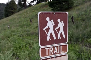
Navigation has always been the foundational challenge of hiking trail experience, and it is the domain where technology has made the most immediately impactful difference for the broadest range of hikers. Getting lost on a trail is not merely an inconvenience. It is a genuine safety risk, the cause of the majority of hiking search and rescue operations, and one of the primary barriers that prevents people from accessing trails beyond the easiest and most well-marked. Traditional paper maps are extraordinary tools when you know how to use them, but the skill of map reading and compass navigation has declined substantially in populations that grew up with digital navigation, and expecting recreational hikers to develop this skill before accessing trails is not a realistic prerequisite for participation. GPS technology embedded in smartphones and dedicated hiking devices has made reliable position awareness on trail accessible to anyone who can operate a touchscreen. When a hiker knows exactly where they are on a trail relative to where they started and where they are going, the psychological experience of hiking changes fundamentally. The anxiety of uncertainty about location, which for many people is the primary source of stress on trail, is replaced by confident situational awareness that allows attention to shift from navigation anxiety to the actual experience of the landscape.
GPS Navigation: How It Works on Trail and Why It Matters
GPS navigation on hiking trails operates through principles that are worth understanding at a basic level because that understanding helps users make better decisions about when to trust their technology and when to supplement it with other navigation tools.
The Difference Between Cellular GPS and Offline Trail Maps
One of the most important technical distinctions that every technology-equipped hiker needs to understand is the difference between navigation that depends on cellular connectivity and navigation that functions entirely offline using pre-downloaded maps. Many hikers have discovered this distinction the hard way, reaching a trailhead only to find that they have no cell service and that the navigation app they planned to use is essentially non-functional without it. Cellular connectivity on trail is deeply unreliable even in regions with generally strong coverage, because trail corridors through forests, canyons, and mountain terrain create dead zones that exist regardless of how many towers are in the general area. Apps that require a live cellular connection to display maps and positions are not reliable trail navigation tools regardless of their other qualities. The essential capability for trail navigation technology is the ability to download maps for offline use before leaving areas with connectivity, and then to use the device’s GPS hardware, which functions independently of cellular service, to display accurate position on those pre-downloaded maps. Apps including Gaia GPS, AllTrails Pro, Avenza Maps, and CalTopo have made offline map download a central feature specifically because trail use has made the limitation of connectivity-dependent navigation so apparent to their user bases. Before any significant trail excursion, the preparation routine should include downloading the relevant maps for the area to be hiked and verifying that position display is functioning correctly while still in an area with connectivity.
Accuracy Expectations and the Limitations of GPS in Dense Terrain
Consumer-grade GPS, including the GPS hardware in most smartphones and many dedicated hiking devices, typically achieves position accuracy of three to five meters under clear sky conditions, which is more than sufficient for trail navigation where the trail corridor is typically several meters wide. However, accuracy degrades under certain conditions that are common on hiking trails, and understanding these degradation scenarios prevents users from making decisions based on position data that is less reliable than they assume. Dense tree canopy, particularly of conifers, attenuates GPS signals and can reduce accuracy to ten meters or more in heavily forested areas. Deep canyon environments block significant portions of the sky, limiting the number of satellites the receiver can access and degrading accuracy substantially. Tall cliffs and rock walls can cause multipath errors where GPS signals bounce off surfaces before reaching the receiver, producing position errors that can be significant. In these environments, GPS navigation remains useful as a general orientation tool but should be supplemented with careful attention to visible trail markers and terrain features rather than relied upon as the sole navigation reference.
Trail Apps Beyond Navigation: The Full Ecosystem of Trail Technology
GPS navigation is the most foundational hiking trail technology, but the ecosystem of apps and tools available to contemporary hikers extends well beyond position tracking to encompass planning, safety, education, and community dimensions that collectively enhance the trail experience across its full arc from initial research through post-hike reflection.
Planning and Research Tools That Make Better Hikes Before They Begin
The trail experience begins long before the first step on trail, in the research and planning phase that determines which trail is attempted, what conditions to expect, and whether the hiker is appropriately prepared for what the experience will require. Apps and platforms including AllTrails, Hiking Project, and OnX Backcountry have created searchable databases of trail information contributed by both professional organizations and the hiking community that make the research phase of trail planning dramatically more efficient and more reliable than it was in the era of guidebooks and word of mouth. AllTrails in particular has assembled a dataset of user reviews, condition reports, and photographs that gives trail researchers access to genuinely current information about trail status, difficulty conditions, and seasonal considerations that no static guidebook can provide. A trail that was in excellent condition when the guidebook was written may be significantly different after a winter with heavy snowfall, a summer wildfire, or a major storm event, and community-sourced condition reports updated in real time by recent hikers provide information currency that traditional resources cannot match. Weather integration has become an increasingly important feature of trail planning apps, with platforms including the National Weather Service’s point forecast tool, Mountain-Forecast.com, and the weather features built into many trail apps providing summit and ridge-level forecast data that differs significantly from valley-floor weather data in ways that matter enormously for safety and experience planning on high-elevation trails.
Safety Technology That Makes Bold Hiking Possible
The most emotionally significant impact of technology on the hiking trail experience may be the expansion of the safety envelope that allows hikers to access more remote, more challenging, and more rewarding trails with realistic confidence that a serious emergency does not have to be a fatal one. Satellite communication devices have transformed the safety calculus of remote trail experiences by providing a means of calling for help from locations where no cellular signal exists and where the nearest road might be many miles away. Devices including the Garmin inReach series, the SPOT satellite messenger, and the Zoleo communicator allow hikers in emergency situations to initiate SOS calls that connect through satellite networks to rescue coordination centers regardless of cellular infrastructure. The emotional freedom that this capability provides is real and practically significant: hikers who know that a genuine emergency can trigger a rescue response even in the most remote backcountry are more willing to attempt the trails that offer the most extraordinary experiences, and they do so with a measured confidence rather than the reckless dismissal of risk that sometimes characterizes inexperienced hikers who misunderstand what their smartphone’s general navigation capabilities can and cannot do in an emergency. Emergency SOS functionality is also available through Apple’s Emergency SOS via Satellite feature on recent iPhone models, which has brought basic satellite emergency communication capability to the devices that most hikers already carry, reducing the barrier to carrying this life-saving technology to zero for a growing segment of the hiking population.
Wearable Technology and the Physiological Dimension of Trail Experience
Smartwatches and fitness tracking devices have introduced a physiological dimension to trail technology that connects the experience of hiking to the body’s internal state in ways that paper maps and guidebooks never could.
How Heart Rate and Exertion Tracking Changes Pacing Decisions
Smartwatches with GPS and heart rate monitoring capabilities including the Apple Watch Ultra, Garmin Fenix series, and Suunto devices provide hikers with real-time physiological data that can meaningfully improve both safety and performance on challenging trails. Heart rate monitoring during hiking provides objective feedback about exertion level that complements the subjective feeling of effort in ways that are particularly valuable at altitude, in heat, or for hikers with cardiovascular health considerations. The perception of effort at altitude is notoriously unreliable, with hikers often feeling less taxed than their cardiovascular system actually is, and real-time heart rate data provides an objective check on perceived exertion that can prevent the overexertion events that have caused serious medical emergencies in altitude environments. Elevation gain tracking, pace monitoring, and calorie expenditure estimation help hikers make informed decisions about turn-around timing, hydration and nutrition needs, and the sustainability of their current pace relative to the remaining distance and terrain. These are not merely nice-to-have data points but decision-relevant information that can prevent the summit fever dynamic where hikers push beyond the point of safe return because the subjective experience of proximity to the goal overwhelms the rational assessment of their remaining capacity and the objective demands of the descent.
Nature Identification Apps: When Technology Deepens Connection to Trail
One of the most compelling counter-arguments against technology on trail is that screens pull attention away from the natural environment that hiking exists to provide access to. But a specific category of trail technology does exactly the opposite, using the camera and processing capabilities of smartphones to deepen engagement with the botanical, geological, and zoological elements of the trail environment rather than distracting from them.
Plant and Wildlife Identification Tools That Transform Understanding
Apps including iNaturalist, Merlin Bird ID, PictureThis, and Seek use machine learning image recognition to identify plants, birds, fungi, and other organisms from photographs taken with a smartphone camera. The experience of being able to point a phone at an unfamiliar wildflower and receive an accurate identification with ecological context about that species within seconds transforms the relationship between the hiker and the botanical richness of the trail environment from passive appreciation to active engagement. Hikers who use identification apps regularly report a shift in their trail attention from a relatively undifferentiated experience of natural beauty to a more specific, curious engagement with the individual elements of what they are moving through. They begin noticing plants they previously walked past without recognition, connecting the names of species to the specific visual and ecological characteristics that make them distinctive, and developing over time a growing vocabulary of natural history that makes every subsequent trail visit richer for the accumulated knowledge. iNaturalist deserves particular mention because it extends beyond identification to community science participation, allowing hikers to submit their observations to a global database of biodiversity records that contributes to genuine ecological research. The act of documenting what you observe on trail and submitting it to a scientific record transforms hiking from pure recreation into a form of engaged participation in the understanding of natural systems.
Final Thought
The hiking trail has always been a place where human beings encounter something larger than their daily concerns, something that requires presence, attention, and the willingness to be genuinely in a place rather than thinking about being somewhere else. Technology, used thoughtfully, does not have to compromise that encounter. Navigation tools that reduce anxiety about getting lost free attention for the landscape. Safety technology that expands the range of accessible terrain opens doors to experiences that would otherwise remain inaccessible. Nature identification apps that name what you are walking through deepen engagement rather than replacing it. The question is not whether to carry technology on the hiking trail but how to carry it in service of the experience rather than as a distraction from it. The trail rewards attention. Technology, at its best, protects and focuses that attention rather than fragmenting it. And that, ultimately, is the promise worth holding onto as the tools continue to evolve.